Public Safety — Law Enforcement, Fire & EMS

Real-time accountability for every officer
& every scene.

Whether it's a structure fire, a wildland operation, an active search, or a multi-agency response, your commanders need to know where every unit is and what they're doing. Vector gives incident command real-time visibility across all personnel, even when comms infrastructure is overwhelmed or unavailable.

The Challenge

When every second counts, you can't afford coordination gaps.

Personnel accountability depends on radio roll calls

On a working fire or active scene, accounting for every firefighter or officer means competing for radio time. PAR checks and status updates tie up channels that should be reserved for tactical communications.

Mutual aid arrives on different systems

When neighboring departments respond, they're on different radio frequencies, different CAD systems, and unfamiliar with your area. Bridging those gaps under pressure costs time you don't have.

Incident commanders lack a real-time picture

The command post gets verbal updates relayed through dispatch. By the time information reaches IC, the situation has already changed. Decision-making is based on stale data and your digital tools aren't helping if they require connectivity to function.

Technology fails in the field

MDTs lose connectivity. CAD goes down during major events. Cell networks get overloaded at large-scale incidents. Even tools designed for public safety can fail when they depend on centralized servers or cloud infrastructure — precisely when the stakes are highest.

How Vector Helps

Incident-ready coordination that doesn't depend on the internet.

Vector gives every responder, from the IC to the newest probie, the same operational picture. Built offline-first with peer-to-peer sync, it works at structure fires, in remote search areas, and during large-scale events when cell networks are overwhelmed.

Location Tracking & Accountability

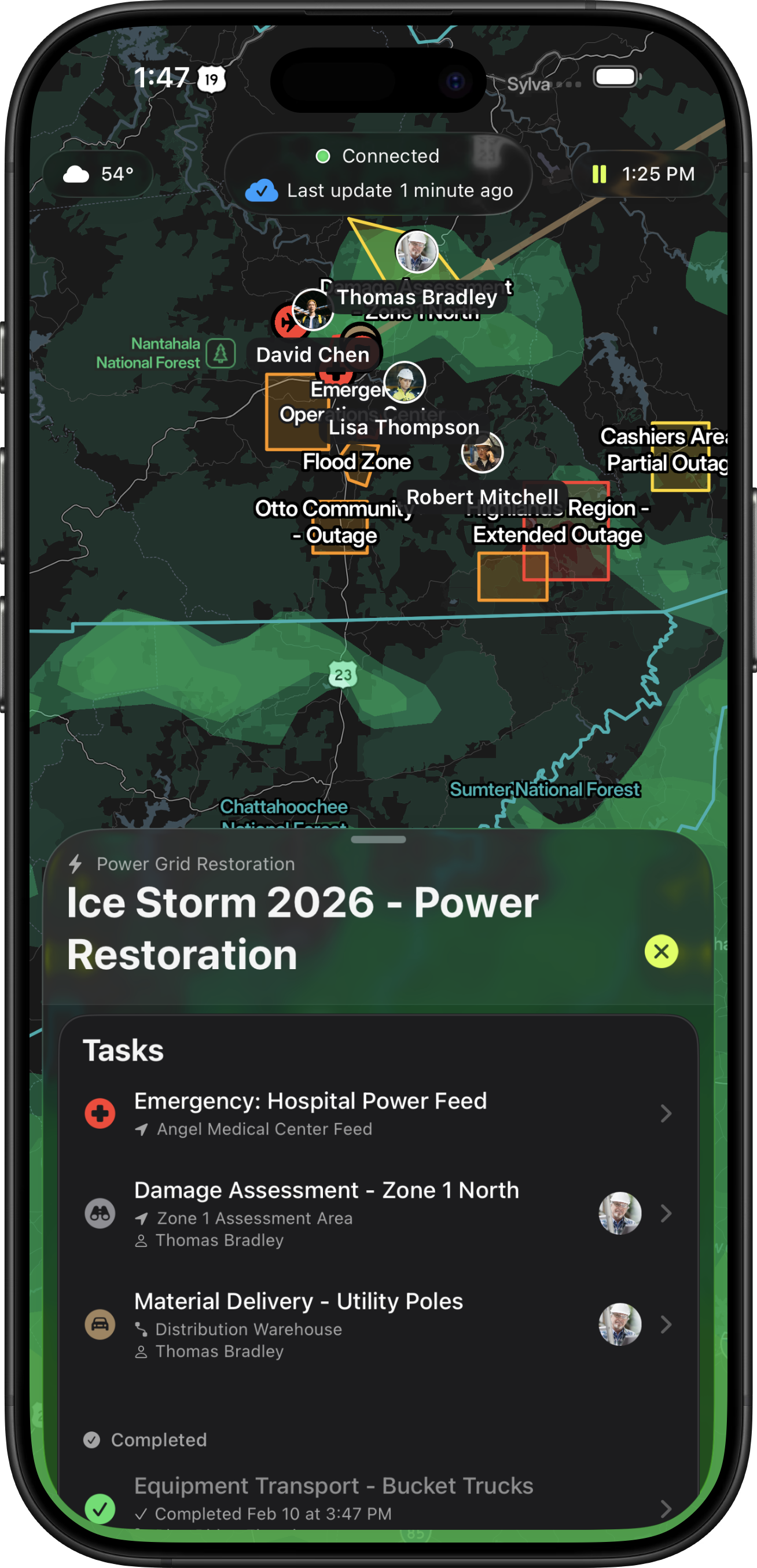
Know where every unit is and
what they're assigned to.

See every officer, firefighter, and medic's position and assignment on a shared map, updated in real time. Incident commanders can monitor from the web-based dispatch interface or an iPad at the command post, while field units use iPhone. Automatic PAR data means accountability is continuous, not something you have to stop and ask for. Track personnel breadcrumbs and movement history for post-incident review and investigative accountability.

Vector real-time team tracking dashboard showing live GPS positions
Resource Management

Apparatus, vehicles, and equipment — tracked and assigned.

Register and track apparatus, vehicles, and equipment with configurable type templates. Drag-and-drop assignment lets you quickly allocate resources to crews and tasks. When assignments change, status propagates automatically. From engines and ladders to medical units and specialty equipment, you always know what's deployed, where it is, and who's using it.

Interoperability

Mutual aid on the same page in seconds.

When auto-aid or mutual aid units arrive, they scan a QR code (or are automatically paired through enterprise SSO) and immediately see the incident picture — assignments, hazard zones, unit locations, and objectives. No accounts to provision, no radio patches to set up, no training required. True interoperability in under a minute.

Tactical Coordination

Tactical coordination
on a shared map.

Draw safety perimeters, hazard zones, and operational sectors directly on the shared map. Tag areas for automatic alerts when units enter or exit. View personnel breadcrumbs and historical movement tracks for scene reconstruction and accountability. Mark hydrant locations, staging areas, and landing zones. Every annotation syncs to all devices in real time through peer-to-peer mesh networking, even without cell service.

Offline-First Architecture

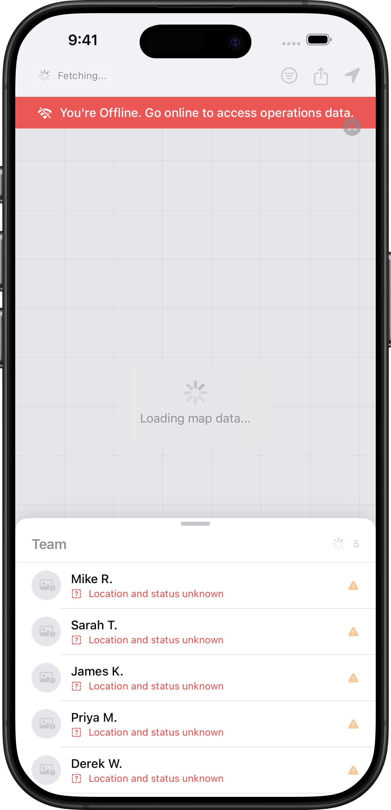
No cell service? No problem.

Vector syncs device-to-device using peer-to-peer mesh networking — no server infrastructure, no access points, no additional hardware. In basements, parking garages, wildland interfaces, or anywhere cell coverage doesn't reach, Vector keeps working. When any device regains signal, everyone's data propagates automatically.

Without Vector
With Vector
App showing no connection error
Vector working offline with full functionality
Integrations

Connected to your
CAD and RMS.

Vector integrates with major CAD and RMS systems. When a CAD incident is created, Vector can instantly alert your team and dynamically assign units, getting the right resources moving before crews even reach the radio. Pushing data to your RMS enables seamless integration with NERIS reporting and post-incident documentation.

CAD RMS
Data

Your data, available everywhere — online or off.

Import GIS layers, custom map data, and real-time feeds directly into Vector. Traffic conditions, weather overlays, fire perimeters, infrastructure maps — all available on every device in the field, even offline. Supports GeoJSON, GPX, and custom data sources so your team has the complete picture wherever the mission takes them.

See how Vector works
for public safety.

From daily operations to large-scale incidents — real-time coordination that works when infrastructure doesn't.

Schedule a Demo Download Now